Paul Broneer’s Working Watercraft of The Levant, Chapter 1
“Paul and I met soon after he wrote to me following Kevin Andrews’ death by drowning on 1 September 1989. (That autumn, Patrick Leigh Fermor, Peter Green, Mike Keeley, and Paul, who had known Kevin all their lives in Greece, offered me their support as I struggled both to deal with Kevin’s death as well as to preserve his diaries and unpublished mss. for future publication. Leigh Fermor, Green, and Keeley had long been my mentors. Paul came to me out of the blue, a sort of Rip Van Winkle figure who emerged, for a moment, from obscurity in Ancient Corinth, only to retire back into the gloaming. I felt him to be someone who had always, would always, live in Oscar’s enormous shadow, and who had, as well, suffered in life and love such that he was ill-equipped to cope with others of his species on a regular basis. To me, however, he was kindness personified.”—Elizabeth Boleman-Herring
The Hubris Book Excerpt
By Elizabeth Boleman-Herring, Publishing-Editor
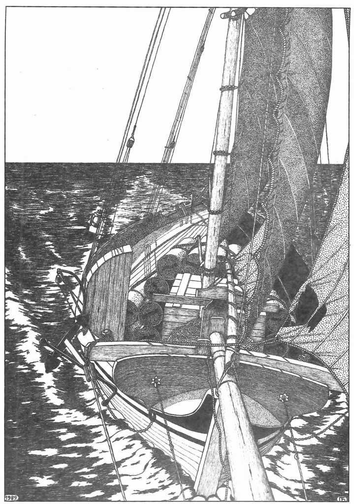
Paul Broneer, Working Watercraft of The Levant (in manuscript form). Corinth, Greece: Chapter 1, The Nautical Region of the Levant. The Southeastern Review, 1990; and Hubris, July/August 2026.
 PENDLETON South Carolina—(Hubris)—July/August 2026—This month, I take up one of three tasks I have put off for far too long, imagining that, in my final decades, I would have the leisure to devote to digitizing as yet unpublished works by Philhellenic friends who have predeceased me: Kevin Andrews, Kimon Friar, and Paul Theodore Broneer. At 74, however, I find myself busier than ever “among the living.” But, still, time’s wingèd chariot . . .
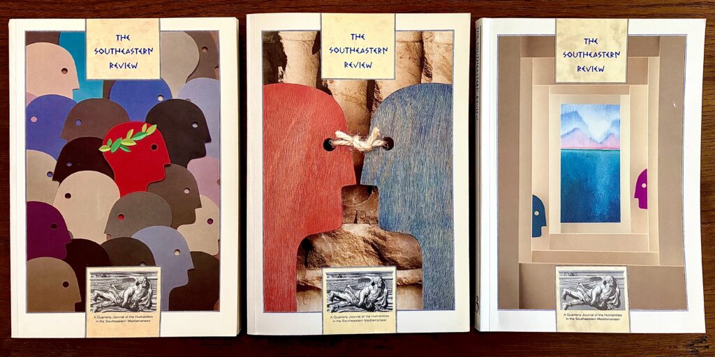
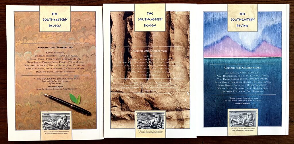
The author of the original, heretofore unpublished manuscript which I will be “publishing in its first iteration” here in Hubris, chapter by chapter, over the course of the coming months—in the hope that, by fixing it in digital form now, it will be available for readers, scholars, and serious publishers going forward—was written by Paul Theodore Broneer (1929-2014), of Ancient Corinth. (One chapter, along with a Glossary and Brief Lexicon, I published in Athens in the spring of 1990 in Volume I, Number 1 of The Southeastern Review: A Quarterly Journal of the Humanities in the Southeastern Mediterranean.)
Paul’s father, Oscar Theodore Broneer (1894-1992), was the illustrious archaeologist and academic who, in 1952, discovered The Temple of Poseidon at Isthmia, and whose works and days are richly documented; his archives preserved for posterity at The American School of Classical Studies at Athens.
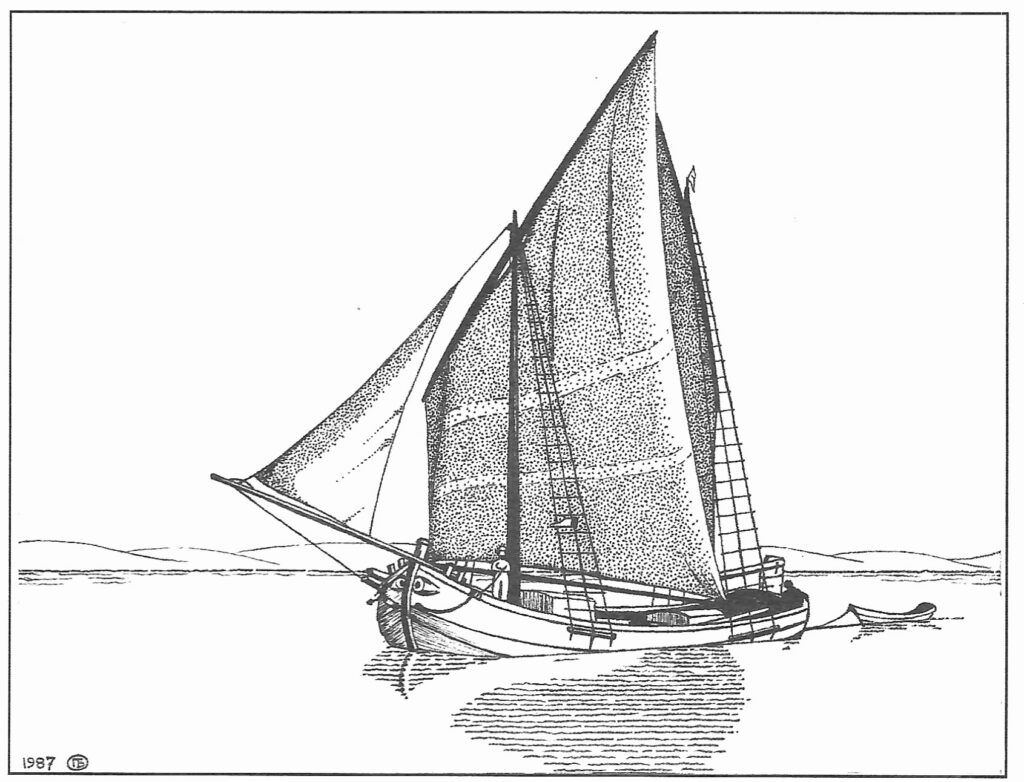
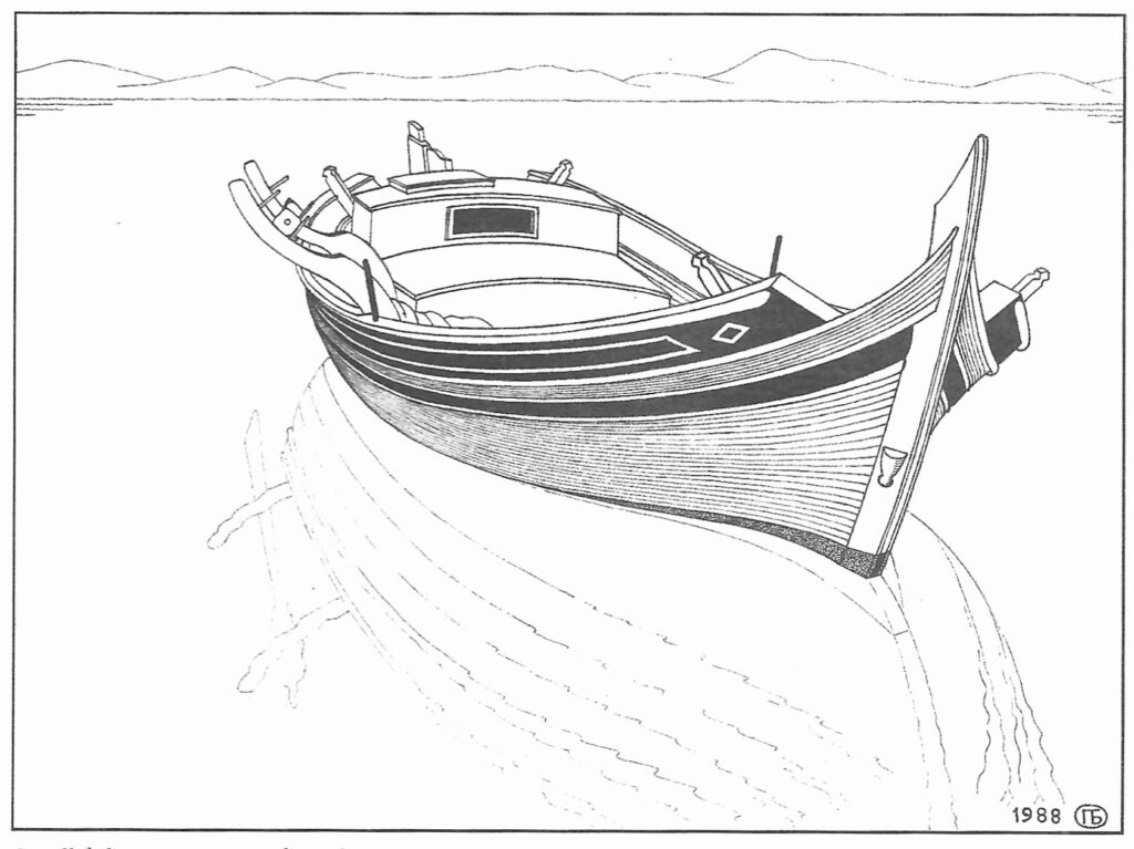
His eldest son, however, though he (along with his younger brother, Jon) inherited his father’s intelligence and intellectual rigor, left only the faintest of footprints for us to follow: no offspring, no publications, and his meticulous artworks—pen and ink studies of scenes in Greece, and the watercraft illustrating his ms. here never collected nor elsewhere published.
Paul and I met soon after he wrote to me following Kevin Andrews’ death by drowning on 1 September 1989. (That autumn, Patrick Leigh Fermor, Peter Green, Mike Keeley, and Paul, who had known Kevin all their lives in Greece, offered me their support as I struggled both to deal with Kevin’s death as well as to preserve his diaries and unpublished mss. for future publication.) Leigh Fermor, Green, and Keeley had long been my mentors. Kevin and I met at a book signing party given for Leigh Fermor; without that chance meeting in Athens, and the events that led on from it, I would not have met Paul.
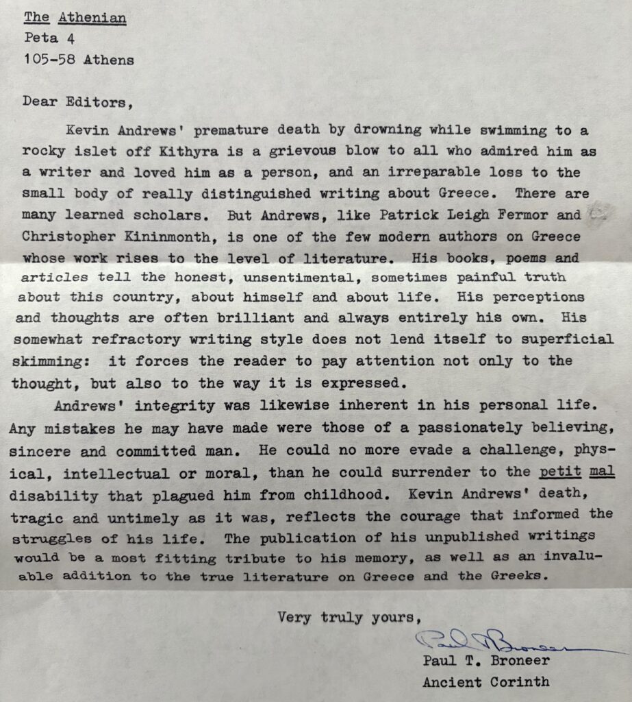
Paul came to me out of the blue, a sort of Rip Van Winkle figure who emerged, for a moment, from obscurity in Ancient Corinth, only to retire back into the gloaming. I felt him to be someone who had always, would always, live in Oscar’s enormous shadow, and who had, as well, suffered in life and love such that he was ill-equipped to cope with others of his species on a regular basis. To me, however, he was kindness personified. We spent one memorable day together hiking up the Akrocorinthos; I have preserved his first letter, sent to me at the old Athenian Magazine offices on Peta Street, and append it at the end of this column.
Kevin’s death launched me into a bitter if blessedly brief period in Athens: that fall, I determined to leave Greece for the foreseeable future, taking up editing work in first Munich and then London before returning to South Carolina to tend to my dying mother in her final year. My life in Greece had stretched, broken only by absences in American high schools and universities, from 1961 till 1989, but I was not to return for some time after that autumn of turmoil and grief. I never saw Paul again.
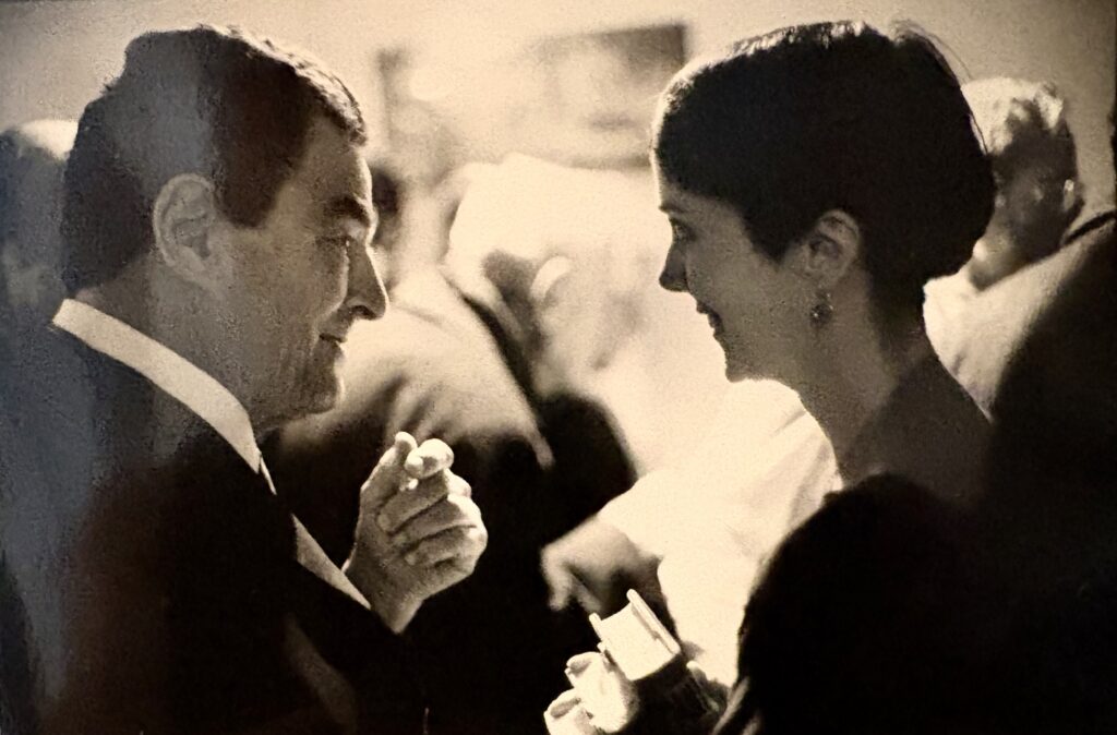
For The Southeastern Review, Paul wrote his own biographical sketch, taking the name “Paul Winroth” so as not to bring Oscar into the picture. It reads:
“Paul Winroth was born in Athens in 1929. He studied Greek and Latin at Harvard, then served as an intelligence officer in Berlin during the Korean War. Afterward, he studied Russian and Byzantine history and literature at Columbia, and both studied and taught geology at the same university. He began sailing on both yachts and merchant ships while still in his teens and has since made yacht deliveries from New England to the Caribbean, captained schooners in the cruising trade, and worked in boatyards in the US and Greece. Eight years ago [in 1981], he began drawing and painting, and his work has been shown in galleries in Boston, in the Boston City Hall, the Boston Federal Reserve Building, and at Corinthian arts festivals. Winroth lives in Ancient Corinth.”
Oscar Broneer famously said, “The treasure-hunter digs to find; the archaeologist digs to learn—and he must learn from everything, cuttings, dowels, lines, weathering, not just works of art or recorded texts.” Paul Broneer, and his widely published brother Jon, each in his own way, bore out their father’s maxim, living it, and learning from everything. Jon’s writings are preserved. Paul’s are just here, in a truncated and temporary form, for the time being. May delving into them provide you, the reader, the rich experience of seafaring Greece they have brought me.
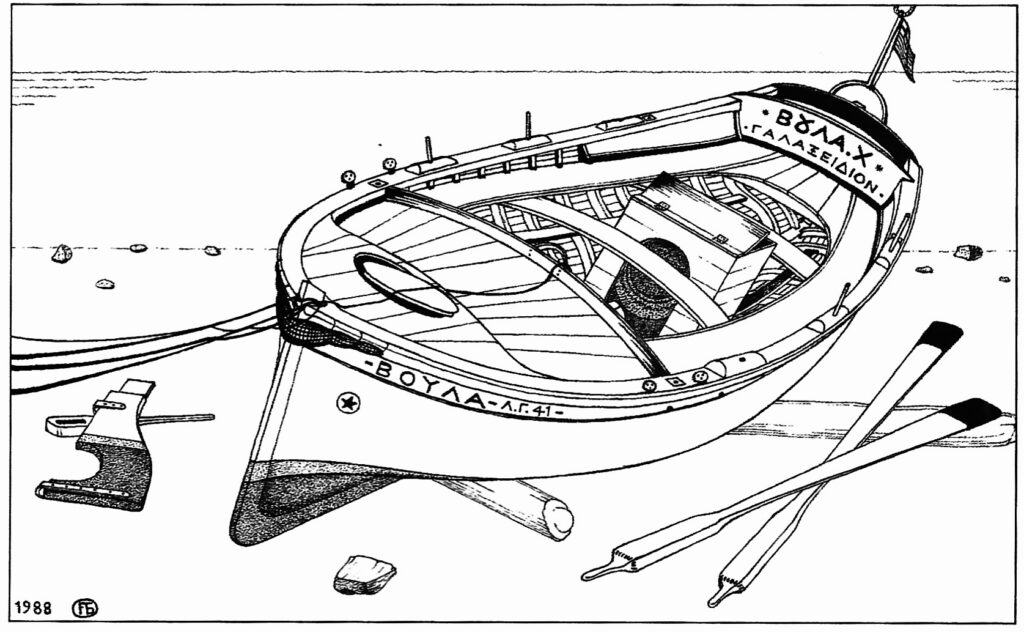
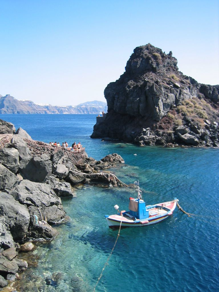
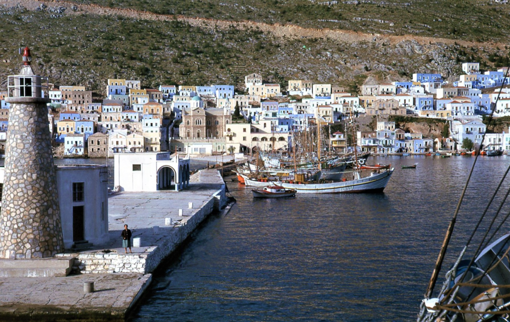
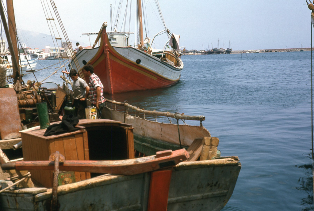
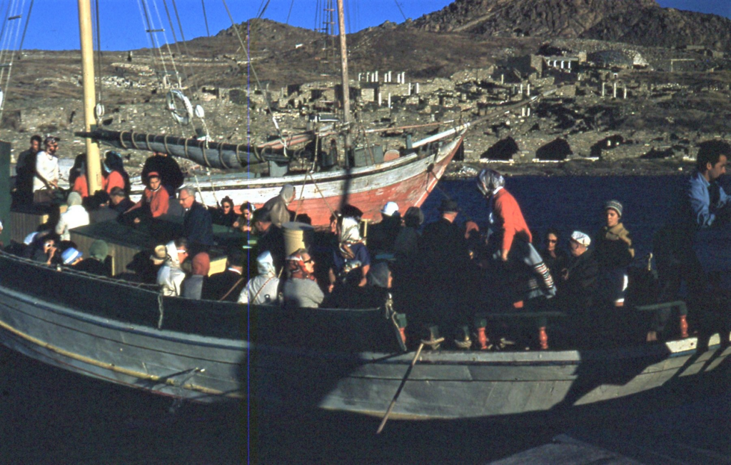
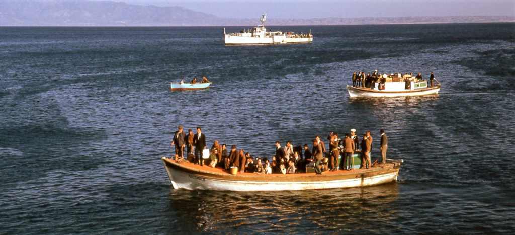
Editor’s Note: I could not have produced this ms. without the help of Ms. Lucy Cooper-Silvis, Hubris’s Assistant Editor and possessor of an essential-skill-set-that-walks-very-much-outside-my-mid-20th-c-body. Gratias ago, Lucy! (Any errors—and there are surely errors—are my own. I have produced a cleaner ms. than I received, but I leave it to the mavens of nautical publishing to make of my draft a book.) I have used, as illustrations, the pen and ink drawings Broneer provided me with in 1990, when I published the first chapter of his ms. I know there must be a trove of his other drawings somewhere, and I am striving to locate them in order to illustrate his as yet unpublished chapters. For the time being, though, I have dropped in my own and my late father’s photographs as a stop-gap measure, and indicate, in captions, their sourcing. I have preserved, with a few minor changes, Broneer’s spellings for Levantine place names: the original chapter, closely edited by the author and by my Co-Editor at The Southeastern Review, Gareth Walters, will be a guide for anyone taking the ms. on into more permanent form. Also, NB, the copyright for Working Watercraft of The Levant and the drawings by the author used to illustrate this ms. remain the property of the estate of Paul Broneer and/or his heirs.
Working Watercraft of The Levant
“. . . steamers with a steel-hulled imperviousness to the emotional needs of humanity pass by without so much as a salute. Their confidence in their ability to bridge the seas can be momentarily desolating. Everything about a caïque is intrepid rather than confident. They are bravely built and bravely painted out but, every time you see them, they seem surprisingly small under the feet of their crew. Yet, in building upon the stocks, more by scowl of brow than by any mechanical precision, the good wood is fitted with a fine confidence, a silly human confidence that is vindicated the moment launching brings the craft in contact with the sea. But when back on the stocks for repair their slack rigging, blistered paint and sea-smoothed hulls tell of the odds they face. If it were not for the soundness of the timbers and the skill of the builders, . . . a tradition of some 4,000 years’ standing, that silly confidence would have been as futile as Daedalus’ when he made Icarus’ wings. Each caique . . . impresses and excites one as a small miracle.” —Christopher Kininmonth, The Children of Thetis, London: John Lehmann, 1949
Introduction
The seas of the historic region of the world known by the romantic name of The Levant bear an equally romantic assortment of traditional wooden ships and boats. This work describes the vessels which ply the waters of Greece, Turkey, and also, in part, [the former] Yugoslavia and the eastern Mediterranean basin. Generations of western travelers and yachtsmen have been delighted by the picturesqueness of these craft, their distinctive shapes and colorful decoration. The vessels are significant also in a more profound sense, because they represent an unbroken nautical tradition going back to before the capture of Constantinople by the Ottoman Turks in 1453, an event often regarded as marking the end of the Middle Ages and beginning of the Age of Exploration. [As I write this in 1990, the tradition is still alive, but in its last days. Another decade or two and these wooden working vessels will have been replaced by steel and plastic. The Levantine seacraft must be studied and preserved now, on the eve of their disappearance, if this major segment of the world’s maritime history is not to vanish with little trace or memory.
Chapter 1: The Nautical Region of The Levant
Limits & Scope
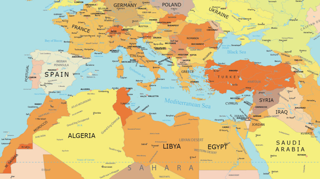
This book describes as comprehensively as possible the still or recently existing Eastern Mediterranean, or Near Eastern, working watercraft, with some information on their history and the maritime tradition they represent. It is also intended as a reference source of information on Greek, Turkish and a few other related traditional ships and small boats. Its scope encompasses the vessels and the seafaring life of what may be called the Northern Levantine nautical region. This region extends from the mouth of the Adriatic Sea down the coast of Greece, north-eastward across the Aegean, through the Turkish Straits and along the south coast of the Black Sea in the north, and southeastward from Crete along the mountainous south coast of Anatolia and Cyprus, as far as Syria in the south. The nautical region of the Levant, thus defined, includes the following elements: 1) the east coast of the Adriatic Sea and its narrow entrance, the Strait of Otranto, between Albania and the heel of Italy; 2) the Ionian Sea and Ionian Islands west of Greece; 3) the Aegean Sea with its coasts and many island, from Thasos in the extreme north to Crete forming its southern boundary; 4) the “Turkish Straits”—the Dardanelles, Sea of Marmara, and Bosporus; 5) the northern or Black Sea coast of Turkey, as far as the Pontic Greek region at the foot of the Caucasus; 6) the south coast of Turkey and the island of Cyprus; and 7) the northeastern corner of the Mediterranean basin, especially the coast of Syria.
The traditional vessels built or used in these areas, although they have differed somewhat from one place to another, especially in past years, are all closely interrelated. They are linked by a uniformity of “style” and represent a single coherent nautical tradition. This unity of the Levantine nautical region and its tradition can be seen by comparing its vessels with those of other contiguous regions. The “dhows” and small boats of Egypt, the Nile River, the Red Sea and the Arab world generally, extending eastward as far as the Malabar coast of India, represent a different tradition unlike and unrelated to the Levantine, with one exception—Syrian “schooner.” The fresh-water craft of the large river estuaries emptying into the Black Sea (in Rumania and the Ukraine), as well as the island lakes and rivers of the Balkan Peninsula, belong to still other nautical regions with their own traditions and style. On the other hand, the old working vessels of the Western Mediterranean (Italy, France, Spain, and the Maghreb portion of North Africa, including the distinctive boats of Malta), although somewhat different from the Levantine, are more closely akin to them, with clear influences and borrowings between East and West. But the Western Mediterranean watercraft have been part of the European nautical consciousness for centuries. They are incomparably better known and more thoroughly recorded, illustrated and studied than those of the Levant. The Western Mediterranean craft, fortunately, were recorded while they were still flourishing, in the mid-19th century, by such nautical historians as Auguste Jal and Admiral Paris. Although the ships and boats themselves have largely vanished, detailed knowledge of them survives.
Character of Levantine Seas
The Levantine seas, owing to the geology of the regions and its natural environment, have their own specific character that in turn has influenced both their ships and boats and their maritime life. Over the past millennium and a half, moreover, the Levant has developed a culture of its own. It has lived through several successive epochs—those of the Eastern Roman Empire, the Byzantine Empire, the Ottoman Empire and its successor nations. During these 15 or more centuries it was a unified entity distinct and sometimes quite isolated from the major regions surrounding it, with their own cultures. Both the relatively unchanging conditions of nature and the always varying and evolving cultural tradition have, each in their own different way, strongly influenced the form, “style,” and use of the traditional Levantine working vessels.
The Aegean Sea at the center of the Levantine region is a shallow, epicontinental sea, beneath which run the submerged continuations of the arcuate mountain chains on the Greek and Turkish mainland. The Aegean Sea floor is thus highly dissected and carved up, and its surface is strewn with thousands of islands, some 200 of them inhabited. The Turkish name for the Aegean, Adaler Denizi, in fact literally means “Sea of Islands.” A few are plutonic and granitic (Mykonos, Ikaria, Eastern Samothrace, and the western part of Naxos), others volcanic (melos or Milo, Thera or Santorin, Aghios Efstratios, western Lesbos), more are of limestone or dolomite, and virtually all are rocky and steep-to. They fell into certain groups: the Saronic Islands, the Norther Sporades, the Cyclades, the Dodecanese, and the large islands of Crete in the south and Euboea, Chios, Mytilene, and others farther north. It is a common saying that nowhere in Greece can one get more than 40 miles away from land at sea or from the sea on land. The peripheral seas of the Levantine nautical region, with waters oceanic depth, underlain by an Earth’s crust of the oceanic type, are the Ionian and Black Seas and the Eastern Mediterranean basin south of Crete, Turkey, and Cyprus. But its heart, the Aegean Sea, like the Adriatic, lies on the continental shelf.
The tides in the Mediterranean Sea are like those of the Baltic Sea and Chesapeake Bay, which have similarly intricate and embayed shapes. The vertical range of the tide in all three is only about one to two feet—less than one meter. Here the tides and tidal currents in general, unlike the variable wind-driven currents, do not greatly affect navigation, and will not leave anchored or stranded vessels high and dry—they must be hauled out to expose their bottoms for cleaning and repair. Yet, besides the inflowing surface currents at its two ends, the Straits of Gibraltar and the Bosporus, some very strong tidal currents in the Mediterranean reverse direction twice a day: through the Straights of the Messina (the ancient Scylla and Charybdis) and the Euripos (at Chalkis, between Euboea and mainland Greece). Powerful wind-driven and bottom currents run through the Kafirevs (the strait between the southeastern end of Euboea and the island of Andros), the Cavo d’Oro Strait between Kea and the tip of Attica, the passage just east of Delos between Mykonos and Ikaria and elsewhere. A curving open corridor relatively free of islands and rocks runs down the middle of the Aegean Sea, from the Dardanelles past Lesbos and Chios, between the Cyclades and the Dodecanese island groups, southeastward past Crete and into the open basin of the Eastern Mediterranean. The Aegean Sea floor along this corridor is a little deeper (though still epicontinental) and relatively unblocked by submerged mountains, fault scarps and similar obstructions.
Cold and partly fresh surface waters (containing about 10 to 20 parts per thousand of mineral salts) pour southward from the Black Sea into the warm and salty Aegean (40 parts per thousand, as compared to “normal” or oceanic marine salinity of 35 parts per thousand), bringing with them a great abundance and variety of fish. Especially during the summer, air streaming intermittently southward from the barometric high-pressure system over the Ukraine to fill the void left by the hot desert air rising over the Sahara creates the strong northerly wind known as the meltemi, which the Ancient Greeks called the Etesian (“yearly” wind). This prevailing summer wind pushes the built-up seas southward through the narrow passages between islands and mainland, and especially through the curving “middle corridor” of the Aegean. The Aegean Sea, moreover, like the Adriatic and the Mediterranean generally, is a narrow, elongated body of water almost completely ringed by high islands or mountain chains, which sometimes shut out the windows and sometimes funnel and concentrate them into turbulent whirling streams.
The Adriatic is also a shallow, epicontinental sea, with many islands strung out along its eastern, or Dalmatian, shore, and with deep water nowhere north of its narrow mouth at the Strait of Otranto. The Adriatic equivalent of the Aegean meltemi is the tramountana, the blustering northerly wind which produces the kind of storm known locally as the bora, whose winds and waves rush southward unimpeded from the Alps just above the Adriatic’s northwestern head. A bora often blows for several days at a time, like ocean gales; the meltemi, by contrast, generally blows hard in the late mornings and early afternoon and then dies down toward dark, although it too can persist. But the Aegean winter gales last for days: more than once have I been stranded for a week or so (to my mixed annoyance and delight) on an island where I had intended to spend only the weekend.
The Ionian Sea to the west is far deeper and its islands (which the Greeks call the Heptanesos—the “Seven Islands”) are fewer and larger. They also differ somewhat from the Greek and Turkish generality, because of their strong Italian and lack of Turkish cultural influence. They have comparatively abundant rainfall and lush greenery the year round, like the west coast of the Peloponnese. At the northeastern end of the Aegean, the Sea of Marmara is fairly deep for its small size. The Black Sea is deeper yet—it is, in fact, geologically speaking, a miniature landlocked ocean lying on the Earth’s crust, with only a single “basaltic” layer, in contrast to the two-layer “granitic/basaltic” crust forming the continents. South of Crete, Turkey and Cyprus, the Eastern Mediterranean basin, finally, is like the Black Sea far deeper and more like an ocean, with few islands and with straighter and less dissected coasts having relatively few ports and natural harbors.
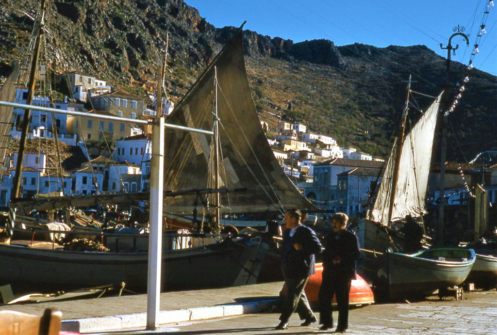
Effect on Seafaring Life
The peculiarity of greatest importance to seafaring in the Aegean Sea is its shallowness and steep, breaking waves, as compared to the oceans and other Mediterranean seas except the Adriatic. Ocean swells are far larger and higher, but less dangerous, than the shallow-water waves in the Aegean (and other shallow bodies of water, like the North Sea, Lake Erie; or Chesapeake Bay, all of which are notoriously stormy and sometimes perilous to navigate). When no impediments are present, the length of the waves (the horizontal distance from crest to crest or trough to trough) is strictly proportional to the wave height (the vertical distance from tough to crest) and to the depth of the wave-caused orbital motion of the water below the surface—but only if the water is deep enough for the wave form to develop without hindrance. All but the very largest modern ship can safely ride up one side of a large ocean swell and down the other, without fear of breaking waves crashing down on deck and overwhelming them. (This also assumes no superimposed cross waves and other complicating and endangering factors, such as turbulence created in the water by the passage of the ship itself through it). But in the shallow Adriatic and Aegean Seas, with their dissected bottom relief, waves can reach only a limited height before the nearby uneven sea floor interferes with the subsurface orbital motion and thus with wave formation at the surface. A short, steep, nasty chop develops and the waves, following close upon each other, soon begin to break of their own accord, even if the strong wind does not whip off their crests like a mounted Saracen beheading his enemy on foot with a slice of his scimitar. A ship’s progress through such a choppy sea is impeded because it is continually stopped by one vertical wall of water after another before it can gather momentum, and its safety is jeopardized by masses of water crashing down on the deck from astern, and also ahead as the ship plunges its nose into the wave in front of it.
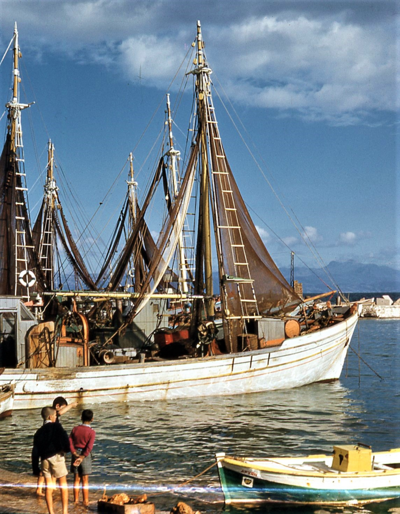
Another essential feature of the Aegean Sea, especially, is its thousands of fairly evenly scattered islands and bare rocks, “like dust upon the sea.” Distances are short. During the sailing season, position finding and course plotting are easy and almost unnecessary: one’s next destination is always in sight or just over the horizon. Many Greek and Turkish traditional vessels, especially fishing boats, carry no charts or even compass, and their crews instead steer by local knowledge and by the stars. Fog is virtually unknown: it occurs for a couple of hours every ten years or so, when many people react to it with superstitious fear as if it were a horrendous calamity unheard of before in human memory. But when a storm blows up, as it does quite often, the abundance of isles and nearness of land mean that there is always a lee shore somewhere nearby, in any direction, no matter which way the wind is blowing. One can never safely heave to and ride out the gale at sea, even if the ship itself is capable of keeping the sea in all weathers: one must seek shelter downwind. In winter, by contrast (the traditional season for hauling ships out for repairs), visibility is severely impaired by the clouds and mist that often conceal or distort the essential landmarks by which the Mediterranean sailor knows his position and shapes his course.
Finding shelter in a storm is made more difficult by another characteristic of the Aegean: though shallow in the large-scale geologic sense, it is far too deep to anchor in. There are some sloping beaches—pebble, shingle, few of them sandy—but most islands and shores are typically steep-to, the water becoming sharply deeper very close to land. The narrow fringe of bright cerulean-green shoal to be seen on a sunny day abruptly gives way to wine-dark blue, almost purple, deep water. And the many islands tortuously carved mainland shores do not generally provide wind-barriers behind which to take shelter in the lee. Instead, they are like obstructions creating turbulence in a wind tunnel. The “lee” side of a cape or island can sometimes be more uncomfortable and dangerous than the water side. Sailors are often told by local boatmen, “When the sea rises, get out of Ierakas Bay!” Or “Don’t try to hide from a meltemi in Kapsali Bay” (on the south coast of the island of Cythera, which the inhabitants still call by its old Venetian name of Tsirigo/Cerigo). “Drop your anchor off Avlemonas instead!” Again, one must take shelter in a proper harbor. Survival at sea in The Levant thus requires tactics, ships and rigs different from those best suited to the open ocean, and those which the Western sailor thinks of as most seaworthy.
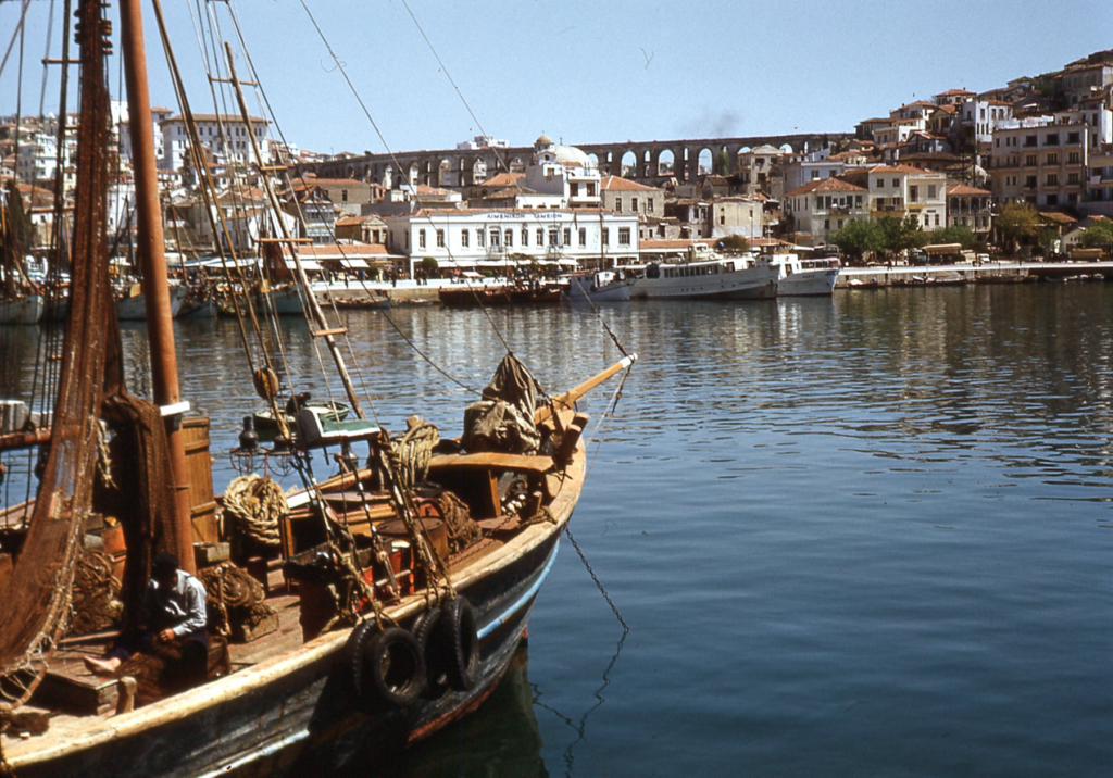
Winds & Harbors
Along the northern coast of the Mediterranean Sea, near sea level, the weather divides the year into two seasons rather than four: a moderately hot and very dry summer, and a moderately cold (but rarely freezing) and fairly rainy winter. The change from one to he other is often abrupt, within a single day, especially in autumn. Only a few of the deepest-rooted plants grow in summer, so that the farmer sows in autumn and reaps in spring. Modern irrigation has softened, but not essentially changed, this harsh contrast. On the sea, in summer, the sky is bright and cloudless even when a gale is blowing, but the winds, treacherous as they sometimes are, permit navigation most of the time. In winter, however, they blow so fiercely and unpredictably that it is suicidal to venture far from shore. Cloud banks obscure not only the sky, but frequently also the near and distant land. Hence the saying: “The fisherman labors while the farmer rests.” The sailing season is from about mid-April to mid-October for the traditional vessels now operating under power. In days of sail without engine, it may have been shorter. Even the large modern steel ships that try to maintain a reduced winter schedule can be involuntarily harbor-bound for a week or more.
Natural harbors, large and small, are both numerous and comfortably well sheltered. Yet some which on the chart look completely enclosed and safe, like Ierax on the southeast shore of the Peloponnese near Monemvasia, are in fact dangerous in a blow or when the sea starts to build. The foreign sailor is wise to seek out and heed local knowledge. Some of these natural harbors have been formed by old, now inundated volcanic craters, like the calderas of Thera (Santorini) and Melos, and many more by the often perfectly round sink holes resulting from karst processes of underground solution and eventual collapse of the cavern’s roof in rocky shores of limestone or of dolomite. Vouliagmeni, the name of many a nearly enclosed round cove in Greece, means, literally, “sunken”. Still other harbors, however, like that of Modern Corinth or Mykonos, are so poor and naturally unprotected that they have had to be closed in by artificial moles and breakwaters. The breakwater keeping the waves out of the southeast side of the small Tourkolimano fishing and yacht harbor at Piraeus is now surmounted by a flashing beacon. It was built in ancient times, as were a number of others still in use elsewhere.
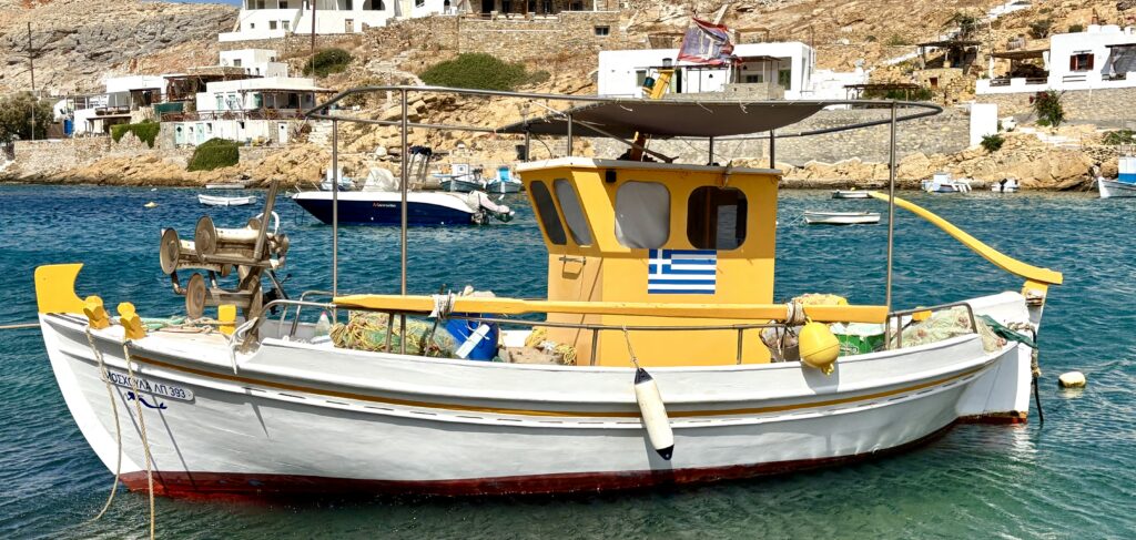
As in the ancient world, the main directions of the compass are not numbered, but known by the winds that blow from them, in Aegean tradition. The winds’ names have changed from their ancestral Hellenic prototypes to the Italianate lingua franca of the Mediterranean, but the principle remains the same. The winds blowing from the cardinal directions of the compass are the Tramountana, the ancient Boreas or northerly wind; the Levante, which blows from the direction of the rising sun; the Ostria, its name a corruption of the Latin Auster, as the Romans called the south wind; and the Pounete or west wind blowing from the direction of the setting sun. The intercardinal directions of the compass are named for the Graigos, Italian gregale, the northeast wind “which blows from Greece” (from the point of view of a sailor somewhere off the east coast of Sicily); the Maistro or northwesterly Mistral; the Souroko or Siroko, the Scirocco which blows from Egypt in the southeast; and the Garbis or southwester. The compass can be boxed in terms of winds with even more detail by combining these names for such directions as north-northeast (Graigotramountana), and so on, for a total of 32 points around the compass circle. As in all other water of the world near land, there are also the Batis or cool onshore breeze blowing onto land in the morning as the rocks give off their accumulated heat, and the Apogeios, the “off-land” or offshore of the evening. For the origins of these and other Levantine or Mediterranean nautical terms, and the names of other winds, see the Lexicon at the end of this book.
Changing Patterns of Trade
Throughout the world, and no less so in The Levant, old trade patterns have from ancient times been governed, or at least strongly influenced, by prevailing winds and currents. Since Greece and Turkey began to transform themselves into modern nations after the European model, the one in the 1830s and the other a century later, a larger regional trade not directly dependent on natural forces has been superimposed on these ancient patterns. It has seemingly wiped them out, at least at first glance. Yet in the Levantine countries, as in other less or more developed nations, the old tracks and trade routes still discernibly persist. International trade, even within the Mediterranean region, of course moves in large modern steel ships, to say nothing of trains, trucks and airplanes. But this international trade is like a big river: it has smaller tributary streams and distributary channels. The automobiles and refrigerators and other manufactured goods and raw materials brought to Greece from Europe or America arrive in Piraeus on large ocean-going steel freighters or tankers, but many are carried by smaller traditional wooden vessels to their ultimate owners and consumers on the islands or in mountain-isolated mainland coastal towns inaccessible by land. The fruits, vegetables, wine and other agricultural produce, local manufactures, what is called “popular art,” semi-finished industrial products or other goods needed to pay for the appliances in the general balance of trade are gathered from all over Greece, often by the same freight-carrying traditional vessels, and brought together at shipping centers like Piraeus, Thessaloniki, or Patras for export in bulk. The same applies to goods manufactured centrally in Greece, at Athens, in Eleusis and elsewhere.
Besides the tributary and distributary function that is ancillary to international export and import, Greece and Turkey like other countries have a self-contained local trade, of perhaps much older ancestry. For example, fruit boats buy produce at wholesale in Palaia Epidhavros or Corinth on the Peloponnesian agricultural mainland and bring it to the island of Aegina for sale at retail directly aboard ship at the quai in Aegina harbor. Other Greek traditional vessels run back and forth with produce, building materials and other goods between Hydra and Ermioni on the mainland of the Troezen, between Spetsai and Porto Heli, between Skyros and the other Northern Sporades islands and the port of Kymi on the northeast coast of Euboea (an island so large, and so near land, as to be effectively part of the Greek mainland), and so on.
In spite of periodically flaring political disputes and military alarms, a lively small-craft trade also persists between the eastern islands of Greece and the Turkish mainland of Western Anatolia, particularly during the summer tourist season. The variety of things transported over larger or smaller stretches of water by Greek, Turkish and occasionally Cypriote or Syrian wooden ships and smaller craft beggars description: not only passengers and their personal belongings, but also fruits and vegetables, wines, live animals and buttered meat, timber from Northern Greece, sacks of grain or flour, mastikha from Chios, loukoumi from Syros, marble from Paros and Naxos as in ancient times, vissanto wine from Santorini and other non-resinated wine from Crete or Rhodes or Thessaly, “antique” chairs from Skyros and carved chests from Lesbos and Samos, woven tweed-like cloth from Mykonos, semi-finished products and scrap iron and fuel oil to and from everywhere, and so on almost without end. No one category or shipment seems to amount to much, but together they make up a very considerable volume of local trade carried on for many generations. And the above enumeration omits fishing and sponge-diving, to say nothing of smuggling, which never quite dies out and occasionally becomes a major industry. All these require transport in small craft. Even the traditional vessels themselves are included: a trehandiri might well be built in a Spetsai yard for a customer far away in Northern Greece, who wants a better vessel for a lower price than he can find nearer home. I first spotted a distinctive and very pretty type of craft now only built on Lesbos (the small fishing perama; see Chapter 4) a long way from home at Phaleron, on the Attic shore quite near Athens.
One picturesque Greek trade once carried on in traditional vessels has, unfortunately, now disappeared: the pottery boats that would load up with bowls, crocks, pitchers, platters, storage jars (pithoi), and the like from a kiln on the mainland and then distribute them at retail in other small coastal towns or on islands. These pottery boats shed some light on the puzzle of ancient, wrecked ships that have been excavated and found to carry nothing but apparently empty amphoras (or do they represent an early form of insurance swindle in antiquity?). As happened earlier in Britain and the United States, however, 20th-century Greece built more and better roads, so that most localities came to be readily accessible by land. After steam and the internal combustion engine became available, first trains and then trucks rapidly put many traditional wooden vessels out of work: the now long vanished coasting schooners and “stone slopes” of New England after the turn of the century, for example. But Greece still has those 200-odd, inhabited islands!
The self-contained partly hidden waterborne local trade of The Levant has existed for centuries and even millennia, but its patterns, routes and centers have shifted in response to political, technological or natural developments. In ancient times, Rhodes supplanted Delos as a center of the Aegean shipping trade, only to be destroyed later by the Romans. In the 17th, 18th and 19th centuries AD, before the Greek War of Independence (1821-1832), Psara, Mykonos, and Chios were among the most important Aegean seaports, trading and ship-building centers, along with Symi, Rhodes, Hydra and Spetsai. As a result of the Greeks’ successful rebellion against the Ottoman Turks, and especially after the massacre on Chios and destruction of Psara in 1822, the position of chief trading center and shipbuilding capital fell to Hermoupolis on Syros—today still the geographic and administrative center o the Cyclades Islands. More trade now moved to newly independent Greece from the West (many Greek ships had carried goods under the neutral Turkish flag during the Napoleonic Wars) and less came from Istanbul, the old Ottoman capital to the east. Large ships brought cargos from the West, around the Peloponnese to the port of entry at Hermoupolis on the Cycladic island of Syros (which became so wealthy as to aspire to the status of a center of culture, with its own opera house, modeled on La Scala). From Syros smaller vessels distributed the merchandise throughout maritime Greece. Yards at Galaxeidi on the north shore of the Corinthian Gulf, near Delphi, built many of those larger Greek sailing ships, and also smaller traditional craft used on the west coast of Greece and its bays and islands.
Trade was altered, finally, when the Corinth Canal was at last successfully cut through the Isthmus, in 1893, after Nero’s failed attempt some two thousand year of previously. The Istanbul trade route was totally cut by the closing of the Dardanelles in World War I. But goods could now be more rapidly and cheaply shipped to and from Athens, or even Thessaloniki, by way of the Gulf of Corinth rather than by the long sea route all the way around the Peloponnese and past the dangers of Cape Matapan and the rocky shoals off Cythera and Anticythera. Thus, Piraeus replaced Hermoupolis as the chief port of Greece, which it continues to be. Meanwhile Salonica, on the northern shore of the Aegean, had become the center of water-borne shipping into and out of Macedonia and the Southern Balkans.
Shipbuilding moved with trade: old centers like Galaxeidi declined around 1900 as new ones like Piraeus developed and prospered. The yards at Perama, just west of Piraeus on the mainland opposite Salamis, building traditional wooden vessels next to larger steel ships (but not in the same yard), employ shipwrights who were born, trained or once worked at former boatbuilding centers like the small isle of Symi, north of Rhodes and 500 yards off the Turkish coast. Similar changes in trade patterns have occurred in the Eastern Mediterranean basin and in the Arabic and East African world; these are traced in comprehensive detail by E. B. and C. P. Martin’s, Cargoes of the East: The Ports, Trade and Culture of the Arabian Seas and Western Indian Ocean (London: Elm Tree, 1978), and by A. H. J. Prins in journal articles and in his book, Sailing from Lamu: A Study of Maritime Culture in Islamic East Africa (Cambridge University Press, 2012).The island of Ruad (ar-Ruad, the Biblical Arwad) off the coast of Syria, to cite another example, used to be the center for the building of the two-masted Syrian “schooners” that from time to time made their way to Cyprus and into Greek waters, as well as the breeding ground of the men who sailed them; now on the island’s yards merely repair these schooners on an ever-diminishing scale. The naval base established after World War II on Ruad has accelerated the island’s decline as a traditional wooden ship-building center by turning it into a largely forbidden zone.
Effects on Vessels of Levantine Province
The characteristics peculiar to the Aegean, and only less so to the other Levantine seas, have affected both the shapes—the full forms and rigs—of vessels and the techniques and strategies of seamanship. Because he generally cannot heave to or anchor or even sail to windward in a steep chop and strong wind, the Greek or Turkish captain must run before the seas to a harbor of refuge downwind. Thalassa piso, miso limani: “A following sea is half a harbor,” or more aptly and less literally put, “When you’re running before the sea, you’re halfway home.” This basic fact of Levantine nautical life, plus the steepness of the waves and their tendency to break, is the main reason for the picturesquely “crescentic” or “quarter-moon” shape typical of both Greek and Turkish vessels, which in this respect resemble the Block Island “cow-horn” of North America. They all, the Turkish craft even more than the Greek, have high freeboard at the ends for their length, sheer and deck camber that seem exaggerated to an American or European sailor’s eye, and very high-steeved bowsprits. Their wide, full flaring bows are balanced by sterns that are somewhat narrower but still full and buoyant. Thus, a following sea neither pushes the stern under as it surges aboard nor lifts it so high that the ship buries her bow or bowsprit in the wave ahead, to be driven under or pitchpoled.
The high solid bulwarks support a weather cloth amidships, or even a second removable upper bulwark, where the sheer is greatest and the outboard edges of the deck of a deeply loaded vessel sometimes actually curve down below water level.
All traditional Levantine craft, large or small, are built smooth-hulled and carvel planked in what used to be thought of as the old Mediterranean or “southern” tradition. Chapter 7 more fully discusses this question and the revised views on it based on underwater archaeology. A “clinker-built” (overlapping planks) vessel seen in Greek or Turkish salt waters is probably either an anomaly or, more likely, a visitor or import from the north. The lapstraked boats once used on the freshwater lakes of Northern Greece belong to a different nautical province and tradition.
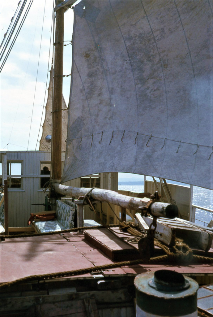
The winds in the Aegean Sea, as in the Mediterranean region generally, blow intermittently and unreliably, especially during the summer navigation season. This is perhaps due to the sheltering and funneling effect of the surrounding high mountain ranges, the difference in specific heat between the sea and the always nearby land, and the turbulence that the many high and steep-sided islands create. “The wind is either too little or too much for sailing and always blows from the direction in which you want to go.” Even during a short passage over the sea, the wind can often change abruptly in direction and strength, without warning, especially near land or islands.
Mediterranean sailors have thus always needed some form of auxiliary power. Since the earliest days they have used various combined oared and sailed vessels (hemiolias and triremes in ancient times; galleasses and xebecs in the early modern era) fir warm commerce and piracy. Some, like the now extinct beaked double-ended vessel called the gaga by the Greek and Turks and once used for fishing and piracy, virtually never carried sail.
The introduction of the internal combustion engine likewise affected the shapes of vessels. The same hull type, whose traditional proportions were narrower and deeper in days of pure sail, usually became wider, flatter-bottomed, shallower and fuller-sterned in the hulls of later generations built for an engine to be installed as the main or only source of propulsive power. Figure (I-6), with two trehandiria on the beach at turn-of-the-century Galaxeidi, shows this difference clearly in comparison to the modern trehandiri in Figs II-8 and II-20, as does the sailing perama in Figure I-7. (Editor’s Note: These numbered figures reference drawings in Broneer’s original manuscript, which is only in part available to me at the time of writing.)
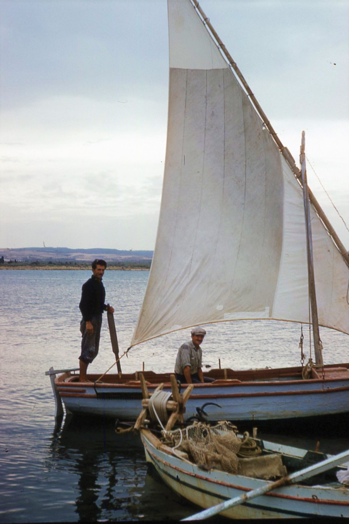
When powered, even the smallest of Greek and Turkish small craft very rarely have outboard motors. Inboard engines are almost universal in Near Eastern waters, because the sharp choppy seas would lift a higher outboard propeller out of the water much of the time. An outboard-powered craft is thus relatively useless except in flat seas and sheltered waters. The outboard motors that have appeared with increasing frequency in the 1980s belong to owners of pleasure boats, mostly weekend fishermen who do not venture out in rough waters or far from home.
Besides power that does not depend on the wind, before and well into the age of motors, Near Eastern seafarers needed sails and rigs which they could lower, furl, brail in or otherwise douse instantly. Hence the former prevalence of lug-sails (the psetha and bratsera), which work well both off and on the wind, of the brailing “curtain” spritsail (sakoulevi), and the lateen.
Because of the small vertical tide range, along with the other characteristics of the Levantine seas mentioned above, even the larger vessels had to be capable of being hauled out of the water on the beach for safety in winter or for storage or temporary cleaning and repair. This helps to account for the long, straight, shallow outer keels, the removable outboard rudders, the small angle of deadrise between the keel and the hard turn of the bilge, and the very massive and strong construction of ships and boats in a part of the world where timber suitable ship-building is not always abundantly available. Today’s virtual abandonment of sail and constant use of motors has also had its effect: traditional wooden vessels built in Greece and Turkey since World War II have been wider and shallower, generally speaking, than their earlier models. I have seen a number of double-ended craft, trehandiria and gaïtes and gantzaoi with anti-squat plates mounted just below the water line above their propellers. The narrow-pointed stern of a double-ender, which is more seaworthy and faster under sail, tends to squat, or sink down too far in the water, as an overpowered engine pushed up the bow on a high bow-wave. It also kicks up a “rooster tail” of spray astern, adding nothing to the ship’s speed but wasting energy and fuel.
Form, Function & Style: A Double Thesis
This work has a “double thesis”: The first proposition is that the functional characteristics of traditional working ships and boats (which have not been so much designed as they have evolved), result from adaptation to the particular nautical environment of the region where these vessels originally developed. When new types are introduced or borrowed from elsewhere (such as the karavoskaro or “Liberty”), they take on the same functional characteristics as the older types of watercraft previously existing in the region. Conversely, when a traditional type indigenous to the maritime province migrates and is used in another region with a different kind of natural nautical environment it loses some of its former functional characteristics and acquires others. For example, the trehandiria used for sponge diving out of Tarpon Springs, Florida, are no longer double-enders, like their Aegean prototypes. Today they have wide, deep, almost rectangular transom sterns of the catboat or “barn door” type, since they are now used in the Gulf of Mexico, where running before the seas and the wind is not of such paramount importance. The functional characteristics relating to rig change more rapidly in general (see Chapter 6), than those of hull form.
Function in this sense, of course, refers not just to seaworthiness, but also to the economics of making a living in particular waters at a particular time. For instance, the extreme sheer and very low freeboard amidships of a number of traditional fishing vessels like the Essex pinky of Massachusetts or the Friendship sloop of Maine, is intended not so much to make the vessel faster or safer as to make it easier for the fishermen to haul their nets or lobster pots aboard. The narrow, deep hulls of the English Channel’s Brixham smacks and trawlers, with their full, right-angled forefoot do make them harder to maneuver and apt to get caught in irons when coming about; the purpose of this hull form is to keep the vessel jogging ahead under reduced sail, with no one at the helm, while the fishing nets are being tended. Similarly, the Greek fisherman in the Aegean in the 1970s evolved the naïnas, a variant of the traditional double-ender: a trehandiri with a low counter stern that is admittedly less seaworthy than the standard version, but far better suited to its use as a stern trawler.
The second part of the double thesis, the corollary of the first, is that the characteristics of traditional watercraft that are not of functional significance—that are, instead, purely decorative, traditional or superstitious in meaning—tend to persist regardless of where or how the vessel is used. For example, the cockscomb-shaped raised stemhead has been retained on the Florida trehandiria although it is not generally used for attaching mooring lines or for any other purpose either in Florida or in Greece. The same is probably true of the exaggeratedly full-bodied, blunt-ended appearance character, and use of a vessel in a simple term or one or two words. It was enough to say “Brixham trawler,” “Humber keel,” “Yorkshire coble,” “Thames barge”—or in North America, “skipjack,” “bugeye,” “New Haven sharpie,” “Tancook whaler,” “Isle of Shoals boat,” “Friendship sloop,” “Block Island cow-horn,” and so on—for a listener familiar with the type mentioned to know exactly what the vessel looked like (hull form, rig, and construction), what it was used for and where.
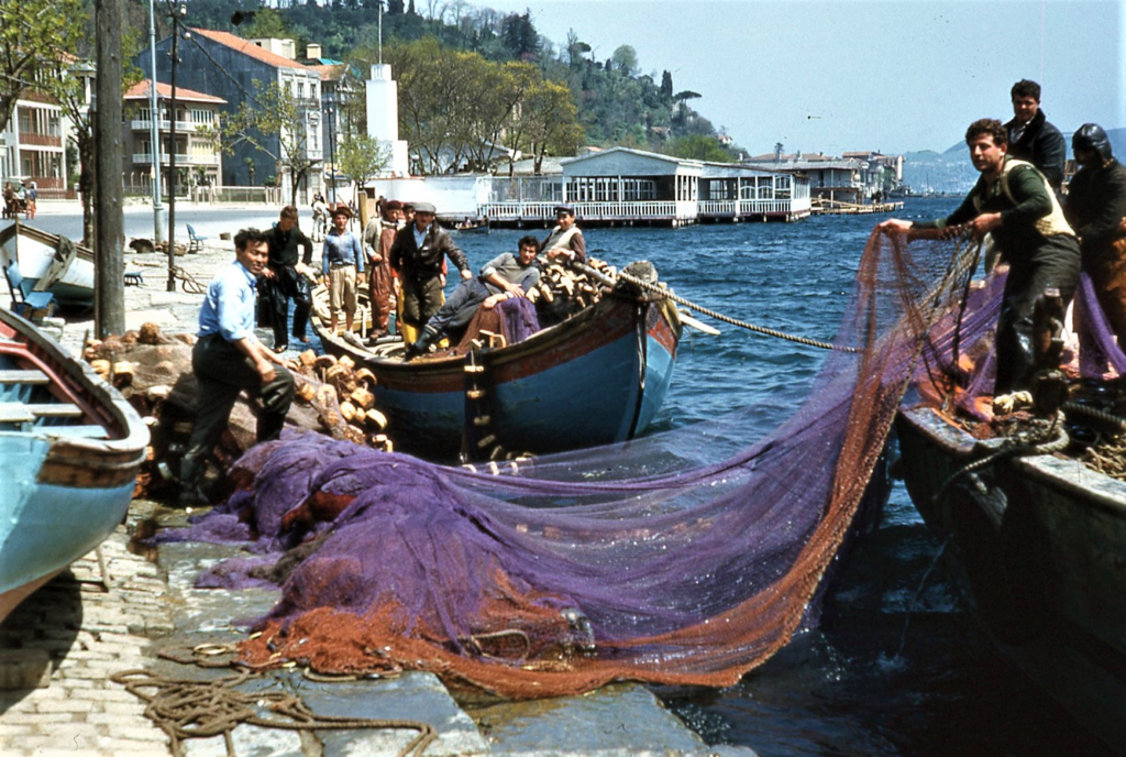
Terminology: Hull Form versus Rig
Something must be said, to avoid endless confusion, about the nomenclature of traditional Levantine ships and boats, as their Greek and Turkish users and builders distinguish and classify them. Nautically minded Americans and Northern Europeans are accustomed to naming and classing sailing ships and even small boars according to their rigs, or sail plans: ship, bark, brig, or schooner; ketch, yawl, cutter, or sloop, etc. Hull shapes or characteristics may be mentioned (clipper bow, spoon bow, counter or transom stem, strongly curved or flat sheer, etc.) but are not criteria in determining the type of vessel.
The type terminology used by the Greeks and Turks in identifying their own traditional craft still follows this older mode, except that both today and in the days of still prevalent sail, the names of the various types of vessels refer exclusively to the hull form, and reveal nothing about the sail plan or other characteristics of the craft. For instance, the Greek name varkalas tells the hearer that the vessel in question is fairly large, of the “ship” category (30 tons or more), with a straight raking stem and a wide, fan-shaped transom stern supporting an outboard rudder. The transom often but not always bears carved ornamentation of a more-or-less standard pattern, the bulwarks extend the full length from stem to transom at the quarters with no cutaway, and so forth. But this name specifies nothing about the rig, origin, or use of the vessel mentioned. This hull type will still be a varkalas whether rigged as a two-masted balance lugger, or a single-masted lateener with perhaps a small transom-mounted jigger, or with a gaff-headed mainsail on a single mast and one or more headsails—or even if it carried no sail or spars at all and goes about entirely under power. The type name varkalas also says nothing about its predominant use; it may be an inter-island general cargo carrier, or a passenger ferry, or a lighter sailing between a small, shallow harbor and the large ships anchored in the roads outside, or a market boat selling fruits and vegetables. Its employment and origin must be specific by other modifying words. Savouradhiko tis Aiginis, for example, tells one that this particular varkalas is from Aigina and is used in carrying rocks and gravel to and from a construction site. (The “dhows” of Arabia, Persia, India, and East Africa are also known and recognized by their bull types alone: the bagbale, zaruk, boden, sambuk, kotia, genje, bum and others almost all carry the same one or two-masted lateen rig).
Thus, the type names for traditional Greek and Turkish vessels in most cases reveal everything about the hull form, but nothing about the rig, origin, use or anything else. Conversely, the names for the kinds of sails and their combinations, or rigs, are not equivalent to the names of the hull forms as terms for vessel types and are never so used. Some statements made about Levantine craft, usually by foreigners, such as, “There are several types—trehandiri, sakoulevi and so on,” are therefore misleading and confusing. A trehandiri hull might well be rigged as a sakoulevi, but if one asks a Greek sailor what kind of boat it is, he will reply that it’s a trehandiri, and go on to say that it’s a fishing or sponge-diving boat from Kalymnos, etc., before he thinks of calling it a sakoulevi. To him, that would be like answering the question: “What kind of building is that?” by saying, “A red tile roof.” Mixing hull and rig names is, to the Levantine sailor’s ear, as incongruous as stating, “There are various kinds of automobiles—Ford, Mercedes, passenger car, and bus.”
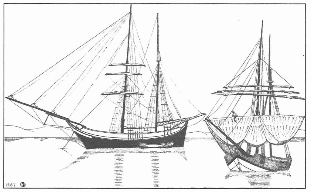
As a general rule, in the modern era, with very few exceptions, any kind of Levantine traditional working vessel (hull type) could carry any kind of sail plan and be used for almost any purpose in any part of the region. In earlier days, a century or more ago, some names for the types of Greek and Turkish craft may have been both more restrictive and more comprehensive: a bellou, for instance, was a small hull of the varkalas type carrying a sakoulevi mainsail plus a square topsail, one or more headsails, and a small lateen or lug mizzen, and was used around Mykonos and other islands of the Eastern Aegean. In Greece today, the almost fully asymmetrical double-ended biyades that resembles an American whaleboat is used only as the seine boat in the fishing-trawler combination known as the gri-gri, and for nothing else. But its equivalent in Turkey, the canoe-like and also rudderless kayak, which the Greeks call a gripos, serves not only as a net boat but also for line fishing and, especially in the past, as a small ferry or water-taxi around Istanbul, Pera, Scutari and the Bosporus. The various kinds of surviving Turkish vessels, however, are both fewer and more specialized than the Greek watercraft (see Chapter 5).
A comment on the world “caïque” (Greek kaïki, Turkish kayak) is in order here. I have not used this word in the title of this book and have avoided it in the text unless it was specifically called for. In Greece, it tells one almost nothing: kaïki means only “boat”—larger or smaller Greek wooden vessel, bigger than a rowboat, if you will, but nothing else. In Turkey, on the other hand, the word kayak refers to the very distinctive kind of larger rowing and sailing boat just mentioned above—a long, narrow, canoe-like double ender with ornamental carving on bow and stern, now used in seine fishing on the Bosporus and once as a small passenger ferry around Istanbul.
The term kayik is not used in Turkish for any other kind of boat but may sometimes refer to “traditional boat” in general. This the use of “caïque” as an English word can lead to confusion.
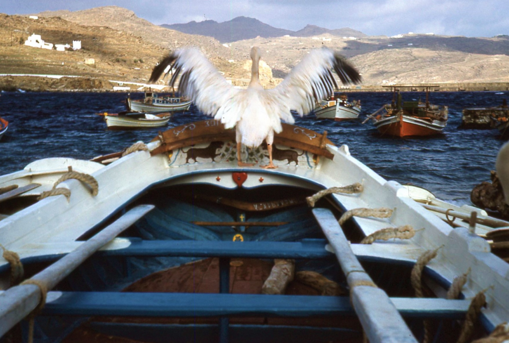
A surprisingly large variety of Greek and Turkish watercraft still survives (or did until quite recently) in Near Eastern seas. There are the Greek double-ended trehandiri, biyades, gantazos, perama, tserniki, gaga, and perhaps notis, the round-sterned karavoskaro, Liberty, and naïnas, and the transom-sterned varkalas (with its variants the bellou, bombarda, and skaphos), kano, and karavosaïta. The Greek salt-water small craft include the double-ended gaïta, priari, and small perama, or peramataki, and the transom-sterned varka me tako, and varka Hydaraïki. The still extant Turkish vessels are the çetrime, the sayka, the çernik, the kayak kancabas, the gir-gir, the alamatra, and the transom-serned taka. In all, about 15 large Greek vessels and five small boat types, and some seven Turkish craft, plus the small sandal, or rowboat.
Individual Ship Names
Although such names as Atromitos (“Dauntless”), Keraunos (“Thunderbolt”), Kali Tychi (“Good Luck”), Despoina (“Mistress”), or Ta Tria Adhelphia (“The Three Brothers”) can be seen here and there, most traditional Greek working and pleasure craft have religious names, Aghios Nikolaos (“St. Nicholas,” the patron saint of sailors, fishermen, and all Greece) is the most frequent, followed in close succession by Evangelistria (“Virgin of The Annunciation”), and then by some local saint or the patron saint of a member of the owner’s family. Turkish vessels, by contrast, seem to bear chiefly such secular names as Sefer Reis (“Voyage Leader”), Osman (the leader for whom the tribe of Ottoman Turks was named), Selçuklar (“The Seljuks”—the Turkish tribe that preceded the Ottomans), or Gulay (“Rose,” or “Lovely”). The religious names of Turkish craft which have them are in a more abstract, less personal style: Kismet (“Fate”), Secat (“Prayer, Prostration”), or Müsselim (“Incontestable”).
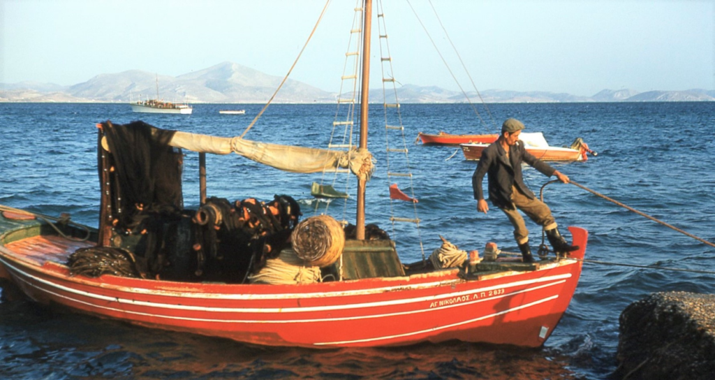
Ancient & Traditional Modern—A Narrowing But Still Unbridged Gap
Some readers may have wondered: “How are these ‘modern’ traditional craft related to ancient ships—at least to the cargo-carrying ‘round ships’ of antiquity?” For once, in my opinion, there is a simple, straight-forward answer: they are not. At least not directly. Ancient Greek vessels carried cargo and passengers over the same waters and perhaps even some of the same routes as the wooden perama, trehandira or karavoskaro of today. Roman freighters sailed over the entire Mediterranean Sea. But the latest ancient cargo ship whose recovered remains are extensive enough to permit reconstruction of the hull form is the early Byzantine ship wrecked in the 6th century A.D. on the Yassi Ada reef near Bodrum (the ancient Halicarnassus and the present sponge-fishing center of Turkey), or perhaps the Serçe Limani ship of the 11th century (see Chapter 7). The earliest date to which I have been able to trace back one of the rare but still extant modern types is about 1520, in Trabzun, the former Trebizond, on the Black Sea. During the long hiatus of ten centuries between these two levels of time—almost exactly a millennium—methods of shipbuilding and the underlying principle of design changed radically, from the “shell inward” procedure represented by the lapstraked Viking ships, for example, to the “skeleton outward” moder of construction following preconceived proportions, plan or model, as in modern wooden ship and boatbuilding. These two procedures are fundamentally different, not just in the superficial appearance of their products. (Chapter 7, on the design and construction of traditional Levantine craft, discusses this whole matter more fully.) Moreover, none of the still remaining or now extinct modern hull forms bears much resemblance to any ancient ship known from sculpture or painting. One can, of course, find rough parallels between them in hull form, length, beam, draft or estimated cargo capacity. But to argue, as some people do, that a traditional modern perama hull is directly descended from a corbita, an ancient Roman freighter of the same dimensions and gross tonnage, from which it is separated by a gap of almost two thousand nautically nearly blank years, is as absurd as to say that it is the collateral relative of a British or American wooden vessel o the same approximate size and capacity.
Comparisons between ancient and traditional modern ships can, however, be justified in this sense: when the structures and shapes of the vessels of antiquity are being reconstructed, and explanations are sought for puzzling features of their design or construction, it is to the traditional wooden vessels of the Western Mediterranean and the Levant that the nautical archaeologist or maritime historian must turn for insight into their function and use—not to the new steel ships and fiberglass boats which are rapidly replacing them. It may be possible someday, after many more ancient and medieval ships have been found and excavated beneath Mediterranean waters, to trace a full line of evolution from the one to the other, link by link. Only this can provide convincing evidence for saying that a given Greek or Turkish type of our own era, or even the entire group of Levantine vessels as a whole, is directly descended from a particular kind of ship or ships of antiquity. In the meantime, drawing superficial and hypothetical parallels between modern traditional and ancient classical vessels is, I believe, merely speculation in advance of the facts.
To be continued in fall and winter issues of Hubris.

Some Sources Consulted
“Oscar Broneer, 97, Archeologist Who Found Ancient Greek Shrine,” The New York Times, February 27, 1992, Section B, Page 7
https://www.nytimes.com/1992/02/27/us/oscar-broneer-97-archeologist-who-found-ancient-greek-shrine.html?shem=rimspwouoe,
“Oscar Broneer, St. Paul, and Wicked Corinth (and a new blog),” by David Pettegrew, Corinthian Matters, October 13, 2011.
https://corinthianmatters.org/2011/10/13/oscar-broneer-and-corinth-and-a-new-blog/?shem=rimspwouoe,
“Replogle Foundation Names Oscar Broneer Room in New Student Center,” Website of The American School of Classical Studies at Athens, August 21, 2020.
https://www.ascsa.edu.gr/news/newsDetails/oscar-broneer-room?shem=rimspwouoe,
“The Oscar Broneer Papers and the Image of Corinth,” by Dallas DeForest, Mediterranean Palimpsest: The history and culture of Greece and the eastern Mediterranean, October 9, 2011.
https://mediterraneanpalimpsest.wordpress.com/2011/10/09/the-oscar-broneer-papers-and-the-image-of-corinth/?shem=rimspwouoe,
Triumph Over Time (1947): The American School of Classical Studies at Athens, by Natalia Vogeikoff-Brogan, 1947.
https://www.ascsa.edu.gr/uploads/media/ToverTbooklet_REV.pdf?shem=rimspwouoe,
“Where There’s Smoke There’s Fire: De Waele’s Story,” by Natalia Vogeikoff-Brogan, From the Archivist’s Notebook: Essays Inspired by Archival Research in Athens Greece, February 7, 2021. https://nataliavogeikoff.com/2021/02/07/where-theres-smoke-theres-fire-de-waeles-story/?shem=rimspwouoe,

Elizabeth Boleman-Herring
Elizabeth Boleman-Herring, Publishing-Editor of Hubris, considers herself an Outsider Artist (of Ink). The most recent of her 15-odd books is The Visitors’ Book (or Silva Rerum): An Erotic Fable, now available in a third edition on Kindle. Her memoir, Greek Unorthodox: Bande à Part & A Farewell To Ikaros, is available through www.GreeceInPrint.com.). Thirty years an academic, she has also worked steadily as a founding-editor of journals, magazines, and newspapers in her two homelands, Greece, and America. Three other hats Boleman-Herring has at times worn are those of a Traditional Usui Reiki Master, an Iyengar-Style Yoga teacher, a HuffPost columnist and, as “Bebe Herring,” a jazz lyricist for the likes of Thelonious Monk, Kenny Dorham, and Bill Evans. Most recently, as MIDCENTURION, she has gone into the antiques (read: upscale picking) business at The Rock House Antiques, in Greenville SC. Boleman-Herring makes her home with the Rev. Robin White; jazz trumpeter Dean Pratt (leader of the eponymous Dean Pratt Big Band); and Scout . . . in her beloved Up-Country South Carolina, the state James Louis Petigru opined was “too small for a republic and too large for an insane asylum.” (Author Photos by Robin White. Author Head Shot Augment: René Laanen.)